Bognor Regis presents two very different excavation challenges depending on where you dig. In the town centre and towards the seafront, you are into the Brickearth and Raised Beach Deposits—relatively recent, often loose materials sitting on a chalk aquifer that starts surprisingly shallow, sometimes less than three metres down. Move north of the A259 towards the Aldingbourne Rife corridor and you encounter thicker sequences of soft alluvial clays and silts, where groundwater is tidally influenced and the ground behaves more like a sponge. Getting a deep excavation right here comes down to reading the water before anything else; our team has spent years logging these transitions and knows that a design that works flawlessly in the London Clay simply will not hold up in a Bognor cofferdam without proper dewatering and base stability checks against the Chalk’s fracture flow.
In coastal Bognor, the cost of a deep excavation failure is rarely just structural—it’s the saltwater intrusion into the works that turns a straightforward dig into a prolonged dewatering exercise.
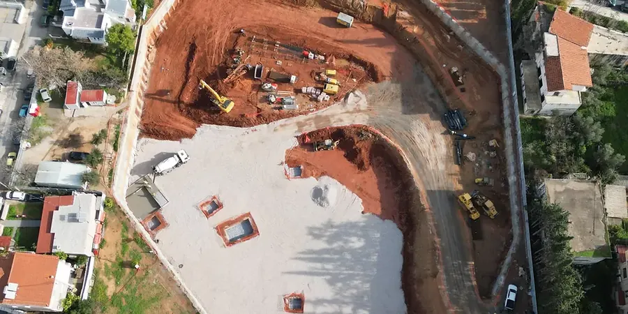
Site-specific factors
We were called in to review a six-metre deep excavation on the eastern edge of town near the Butlin’s complex. The contractor had installed a sheet pile wall to refusal but was losing fines through the interlocks at every low tide, creating sinkholes behind the wall that undermined a live sewer main. The forensic investigation showed that the original ground model had assumed a simple two-layer system, missing a thin lens of running sand at the Chalk interface. Because we had previously mapped this lens during a nearby CPT test campaign, we could quickly redesign the base seal and specify a permeation grouting programme that stabilised the sand without requiring a full re-drive of the piles. In Bognor, these thin, discontinuous strata are the rule, not the exception.
Common questions
How much does a geotechnical design for a deep excavation typically cost in Bognor Regis?
For a standalone temporary works design package covering retaining wall analysis, dewatering specification, and a CAT 2 check, the fee typically ranges from £1,820 to £6,850 depending on the excavation depth, complexity of the ground profile, and the number of construction stages to be modelled. A simple single-propped sheet pile in uniform ground sits at the lower end; a multi-level secant wall with 3D corner effects and tidal groundwater modelling moves towards the upper range.
What is the biggest geotechnical challenge for deep digs in Bognor’s coastal geology?
Without question, it is the management of groundwater in the fractured Upper Chalk. Unlike a porous soil where flow is predictable, water moves through fissures that can open during excavation stress relief, and the tidal connection means inflow rates can double at high tide. This demands a design that treats water control as a structural load case, not just a site management issue, and often requires cut-off walls keyed into less fractured chalk or a base grout plug to create a practical working environment.
Do you use numerical modelling for Bognor excavations, or is limit equilibrium sufficient?
We use both, depending on the project risk classification. For a straightforward cantilever wall in competent chalk with no sensitive structures nearby, limit equilibrium (e.g., FREW, WALLAP) is solid and fast. For excavations deeper than eight metres, those with multiple prop levels, or where we are within the zone of influence of a listed structure on the Bognor seafront, we move to finite element analysis in PLAXIS. This captures the soil-structure interaction, the pre-failure movements in the ground, and the groundwater coupling that a simple wedge analysis cannot resolve.
What temporary works design checks are mandatory under UK law for a deep excavation?
Under BS 5975:2019, any deep excavation is classified as temporary works and requires a formal design with a Design Check Category assigned. For most excavations in Bognor, given the consequence of a collapse in an urban or coastal setting, a CAT 2 check is the minimum—meaning an independent engineer not involved in the original design must verify the calculations, drawings, and method statements. If the excavation is deeper than six metres or adjacent to a highway or railway, a CAT 3 check by a third-party organisation is often specified by the Principal Designer under CDM 2015.
How do you verify that the ground model used in the design matches real conditions during excavation?
We embed the observational method from Eurocode 7 into every design. This means we define trigger values for wall deflection, groundwater drawdown, and prop loads before construction starts. During the dig, we specify an excavation monitoring plan using inclinometers in the wall, piezometers at multiple levels in the Chalk, and load cells on the props. If any monitored parameter approaches 80% of the design trigger, the contingency measures—additional dewatering wells, a berm, or a revised propping sequence—are implemented without delaying the programme. This closes the loop between the design assumption and the ground’s actual behaviour.