The ground beneath a building site in Aldwick behaves quite differently from what you will find up around North Bersted, and that contrast is not always obvious from a simple borehole log. Along the coastal plain of Bognor Regis, the transition from raised beach deposits of the Goodwood-Slindon formation to the softer Bracklesham Beds can shift within a hundred metres, altering the dynamic stiffness of the soil profile in ways that matter for seismic design. A MASW survey lets us map the shear wave velocity profile continuously, giving engineers the VS30 value they need to classify the site per Eurocode 8 without relying on proxy correlations alone. In our experience, combining this surface-wave method with a targeted SPT drilling programme gives the most defensible ground model for foundations in the town's variable Quaternary geology.
A site's VS30 value can shift the design spectral acceleration by over 30% compared with default ground type assumptions — measuring it directly changes the structural cost equation.
Common questions
How much does a MASW survey cost for a residential plot in Bognor Regis?
For a single-family residential plot requiring one or two MASW spreads, the cost typically falls between £1.330 and £2.330, depending on the number of array positions, the required depth of investigation, and site access conditions. We provide a fixed-price proposal after reviewing the location and the structural engineer’s requirements.
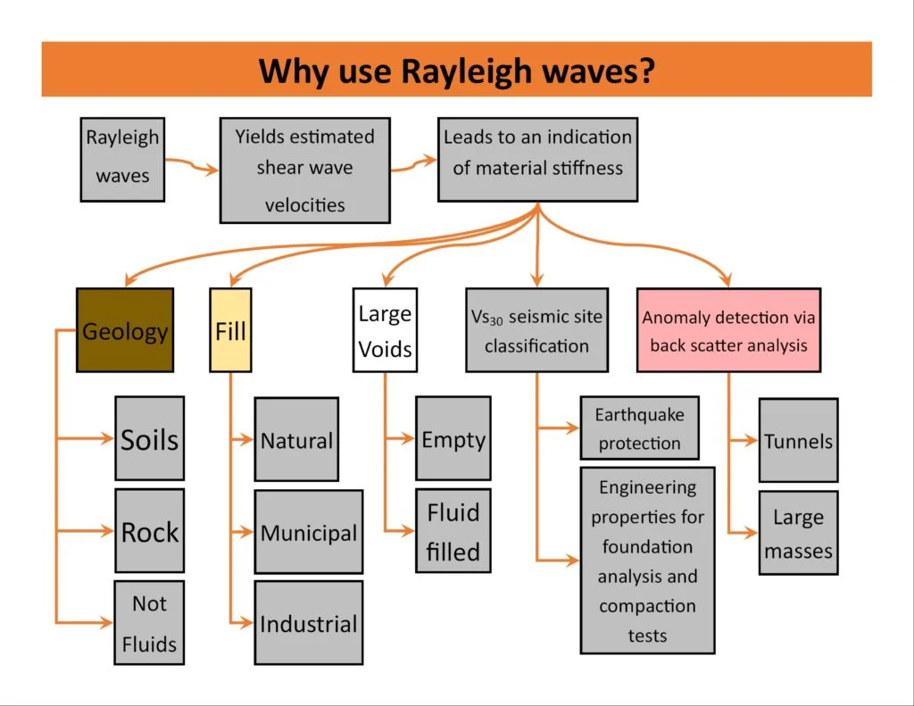
Does Bognor Regis really need a seismic site classification?
While the UK is a low-to-moderate seismicity region, BS EN 1998-1 still applies to structures in consequence classes CC2 and CC3, and the local ground conditions — particularly the soft brickearth and saturated sands of the coastal plain — can amplify ground motion significantly. A measured VS30 avoids conservative default assumptions that add unnecessary cost to the foundation design.
How does MASW compare with a downhole seismic test?
MASW is non-intrusive and tests a larger volume of ground laterally, giving a more representative average VS30, whereas a downhole test measures velocity directly at the borehole wall and requires a cased hole in good condition. In Bognor Regis soils, where the London Clay surface can be weathered and irregular, the surface-wave approach often produces a cleaner dispersion curve with less near-field disturbance.
What depth can a MASW survey reach on the West Sussex coastal plain?
With a 48-channel spread and a 4.5-metre geophone spacing, we routinely achieve reliable shear wave velocity profiles to 35–40 metres depth. The soft alluvial cover overlying the London Clay in the Bognor Regis area provides good Rayleigh wave propagation, and we can extend the investigation to 60 metres by increasing the source offset and array aperture.
How long does it take to get the VS30 report after the field survey?
Field acquisition for a standard two-line MASW survey is typically completed in one day. Processing, inversion modelling, and reporting take five to seven working days, and we can fast-track the preliminary VS30 value within 48 hours if the design team needs the site class urgently for a submission deadline.