Out here on the West Sussex coastal plain, the ground tells a complicated story. The Brickearth, London Clay, and chalk are interbedded with sand and gravel lenses that can vary dramatically over a few metres. We run vertical electrical sounding lines across building plots in Bognor Regis to map where the water table sits, how thick the superficial deposits are, and whether those gravels are continuous enough for a drainage field. The chalk itself brings a sharp resistivity contrast, which makes this method particularly effective for depth-to-bedrock profiling. Before investing in a full intrusive investigation, a resistivity survey gives us the stratigraphic big picture and helps target boreholes where they will actually add value rather than just costing the client money.
A well-calibrated VES curve across the Bognor Regis coastal plain can distinguish between a 1.5 m and a 3.2 m gravel lens without a single borehole.
Approach and scope
Bognor Regis sits on a complex Quaternary geology where the raised beach deposits and the Aldingbourne gravels create a layered resistivity signature. The mean annual rainfall here, around 740 mm, keeps the shallow Brickearth partially saturated, lowering its resistivity to between 15 and 40 ohm-m. We use a Wenner or Schlumberger array depending on whether the site is a tight back garden or an open greenfield. For foundation design on the London Clay, we often combine this with
test-pits to calibrate the geophysics against a physical log. When the client needs to confirm chalk rippability or detect dissolution features, the VES curve shape speaks volumes. In some areas near Aldwick, we have mapped buried channels where the resistivity drops below 10 ohm-m, flagging soft infill that a standard window sampler might miss.
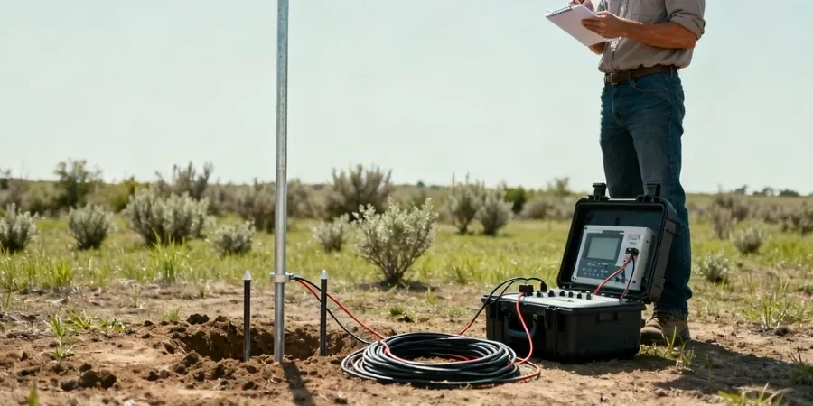
We run the survey with a multi-electrode system to get repeatable contact resistances even in dry summer conditions. The data is inverted with smooth-model least-squares software, and we present the final section with RMS error below 3%. For soakaway testing, the resistivity profile helps us position a
in-situ-permeability test exactly where the granular layer is thickest, saving the contractor from abortive pits.
Site-specific factors
BS 5930:2015+A1:2020 requires ground investigation to extend below the zone influenced by the proposed works, and in Bognor Regis that zone frequently includes the transition from superficial deposits into chalk. If the VES survey misses a narrow solution feature or a perched water table in the gravels, the foundation design can be under-engineered. The biggest geophysical risk here is equivalence: a thin, highly conductive clay layer can suppress the same VES curve shape as a thicker, moderately conductive one. We break that ambiguity by tying every line to at least one calibration point, typically a cpt-test or a trial pit log. Without that calibration, the interpreted depth to chalk could be off by a metre or more, and on a sloping site that error translates directly into pile length miscalculations.
Common questions
How much does a VES survey cost for a typical Bognor Regis building plot?
A single VES sounding with interpretation generally runs between £470 and £810, depending on the target depth and whether we need to use longer spreads to reach the chalk. A full 2D line with multiple soundings will be at the upper end or beyond, especially if topographic survey is required.
Can resistivity tell the difference between London Clay and the chalk beneath Bognor Regis?
Yes, and it does so quite clearly. The London Clay typically reads 10 to 30 ohm-m, while the chalk usually exceeds 50 ohm-m and can go above 200 ohm-m when dry and fractured. The steep gradient on the VES curve marks the transition.
Does a resistivity survey work in small back gardens?
It depends on the target depth. For shallow investigations down to 5 or 6 metres, a Wenner array with 1 to 3 metre electrode spacing fits most residential plots. If we need to reach deeper chalk, we may need to use a Schlumberger array with the current electrodes placed outside the garden.
How long does a VES survey take on site?
A single vertical electrical sounding with a crew of two takes about 45 to 75 minutes, depending on the number of depth increments. A 2D imaging line of 100 metres with 2-metre electrode spacing takes roughly two hours including setup and cable layout.